Ahmad Assi

Academic  /  2024

Serenade Park

A park for a new transit-oriented district at Bowesville, organised around a lake and a sequence of named grounds rather than one open lawn, with the streets around it sectioned and dimensioned.
Project type
Public park and landscape proposal
Location
Bowesville, Ottawa, Ontario
Status
Academic
Area
Drawn at 1 to 200
Role
Sole author, ARCS 3304 final project

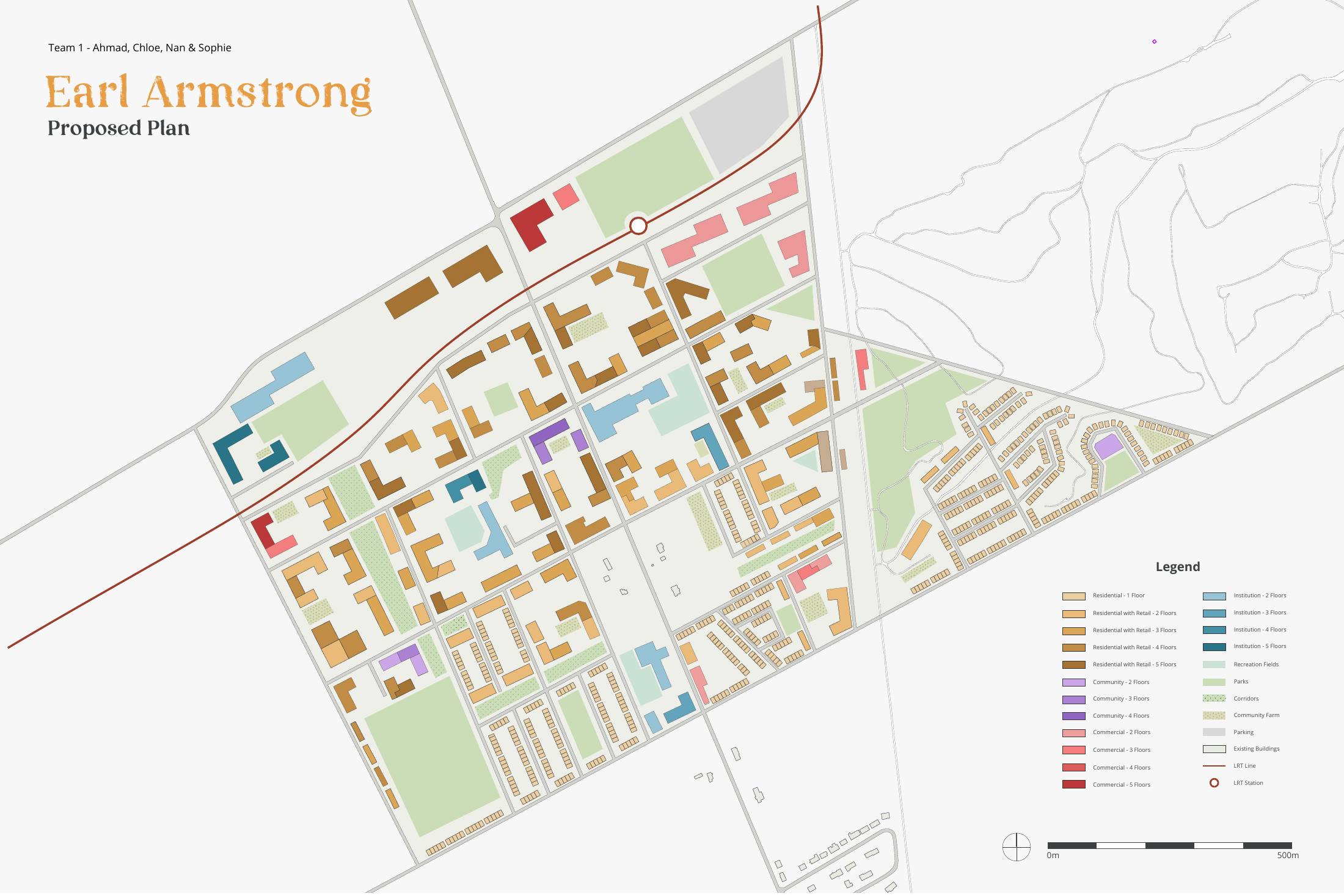
Bowesville is a station area rather than a neighbourhood yet, which is the interesting part. The area plan our team produced for Earl Armstrong sets out the blocks, the uses and the storey heights around a new light rail stop, colour coded from single storey housing up to five storey commercial, with parks, corridors and a community farm threaded through it.

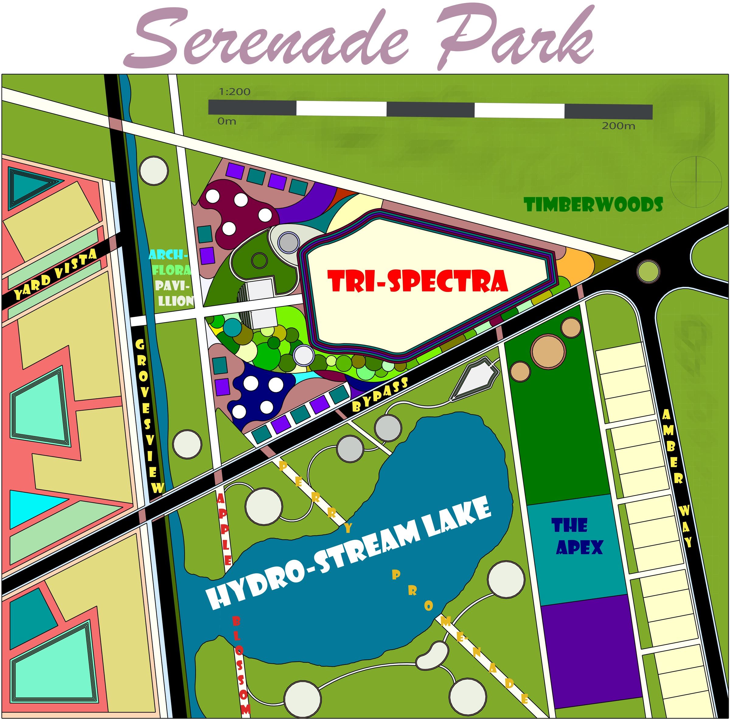
Serenade Park is my own piece of that: the public open space at the centre. Rather than one lawn, it is a sequence of grounds with their own names and their own jobs, arranged around Hydro-Stream Lake. Tri-Spectra holds the north edge as the main gathering plaza, the Arch-Flora Pavilion sits in the planted ground to its west, Timberwoods keeps the treed edge, and a promenade runs down the lake to The Apex at the south.

Naming the parts was not decoration. A park that reads as one undifferentiated green is used as a shortcut; a park made of places people can arrange to meet at gets used as a destination.

The park is designed to change with the season rather than look best once. In spring it works as a greenhouse and community garden, in summer as an outdoor venue for concerts and events, in autumn as a maze and corn field, and in winter as an outdoor rink and a venue for ice shows. A water retention system runs underneath all of it, holding runoff from the blocks around the park and returning it to the lake.

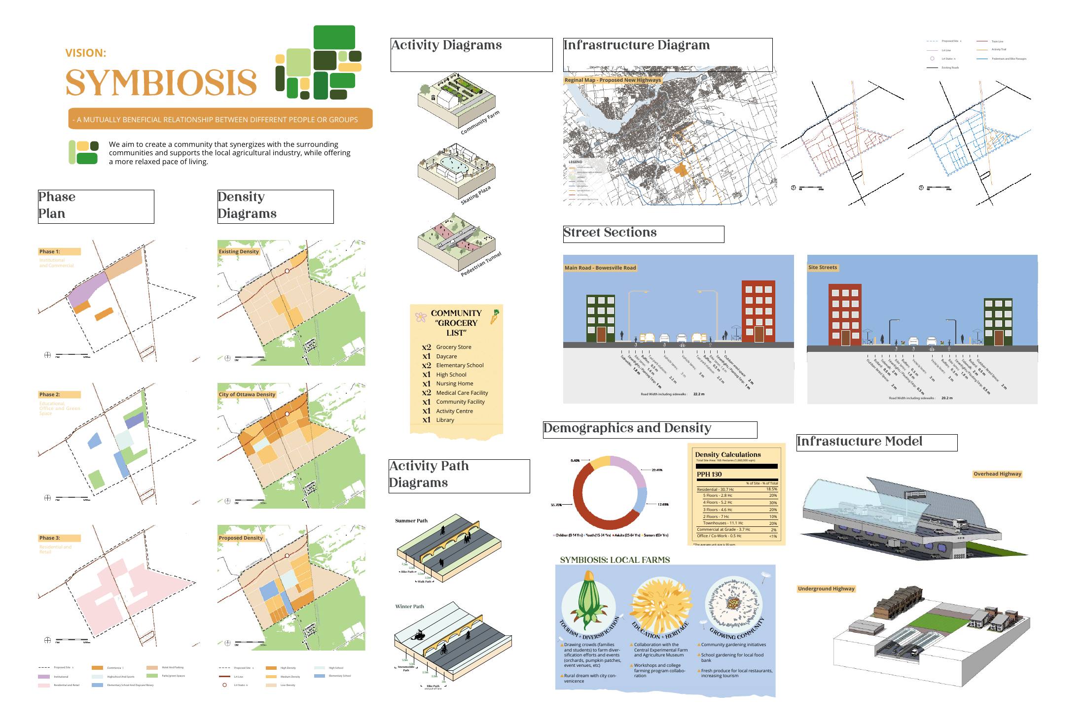
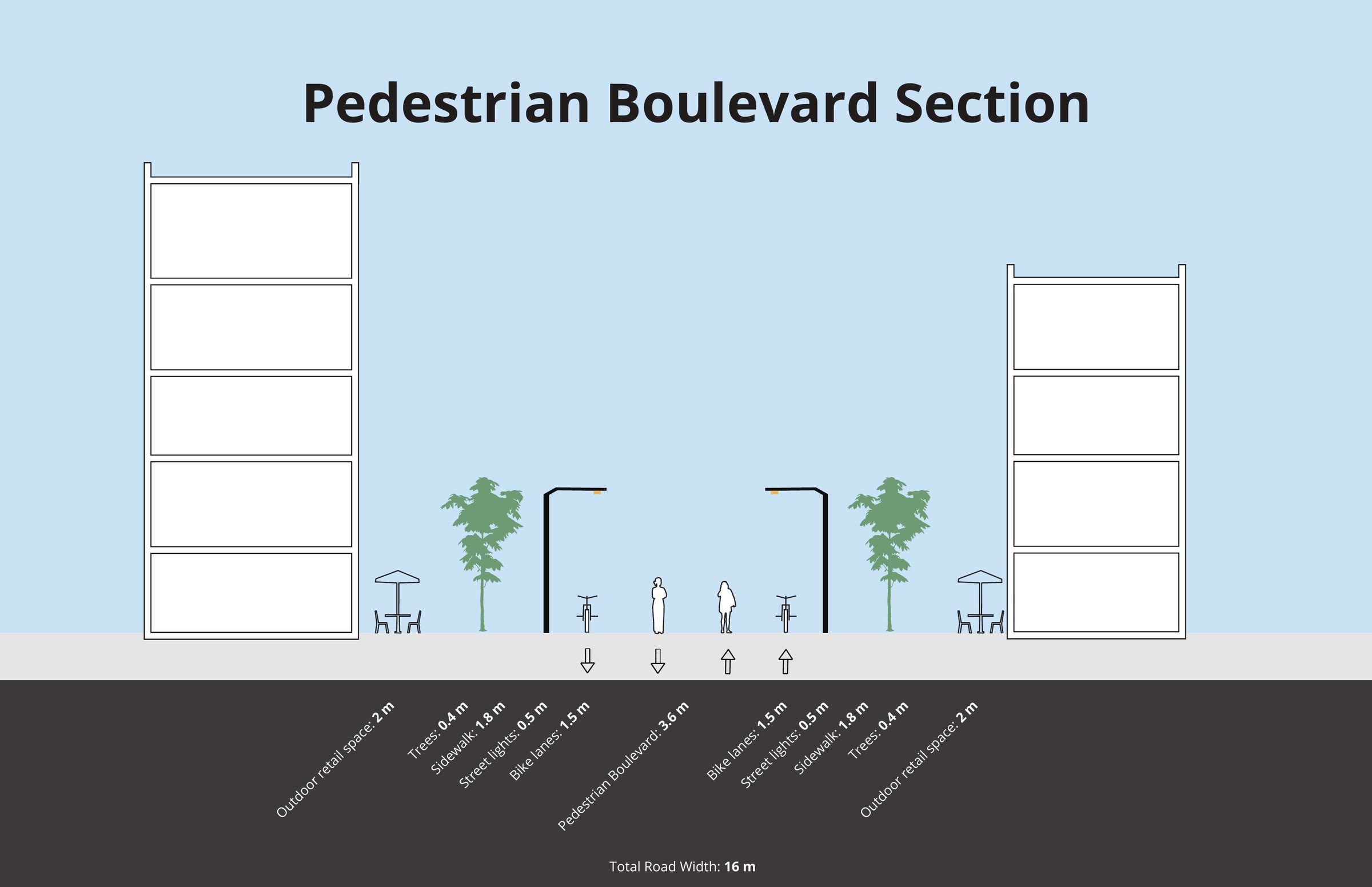
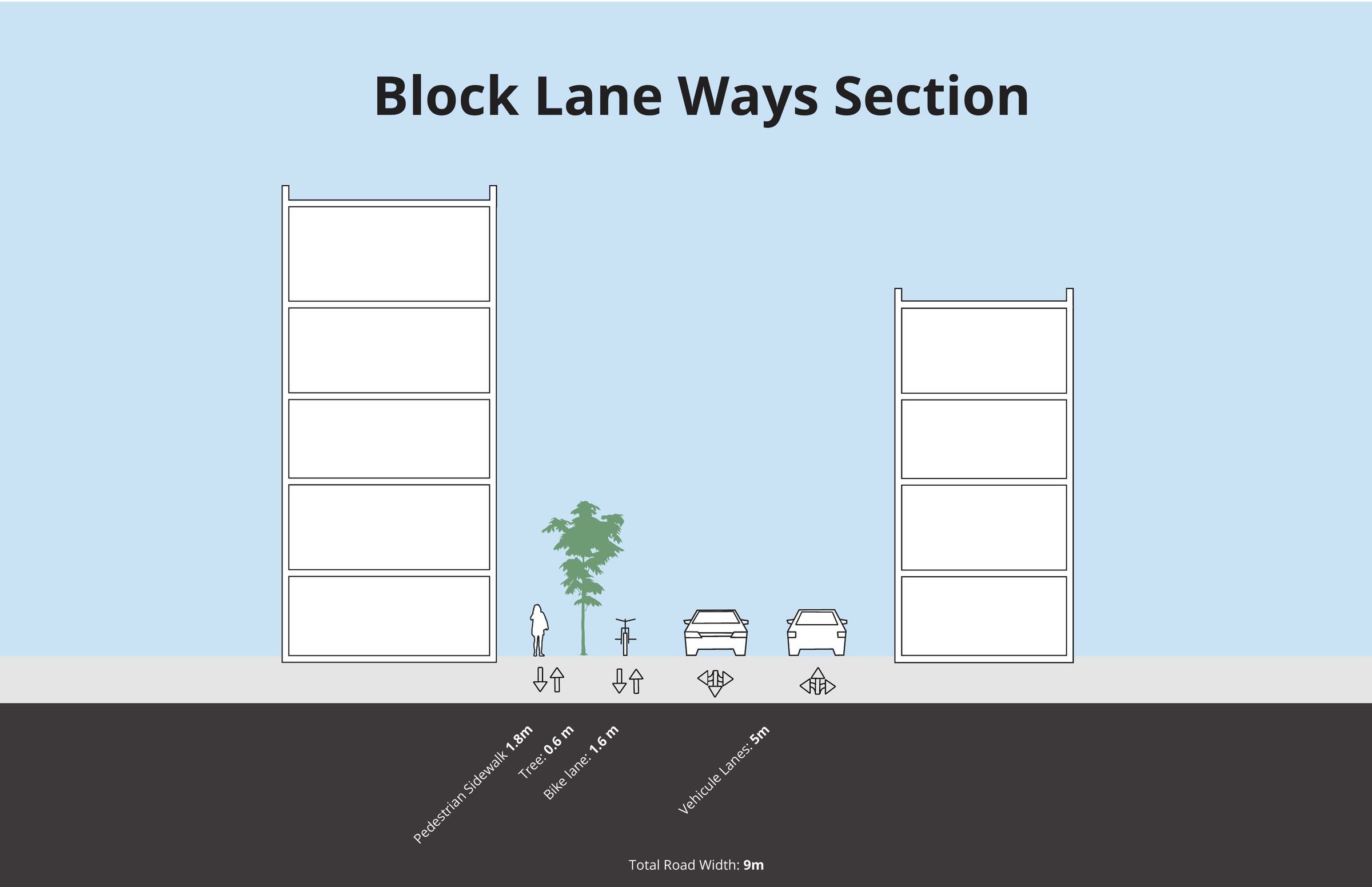
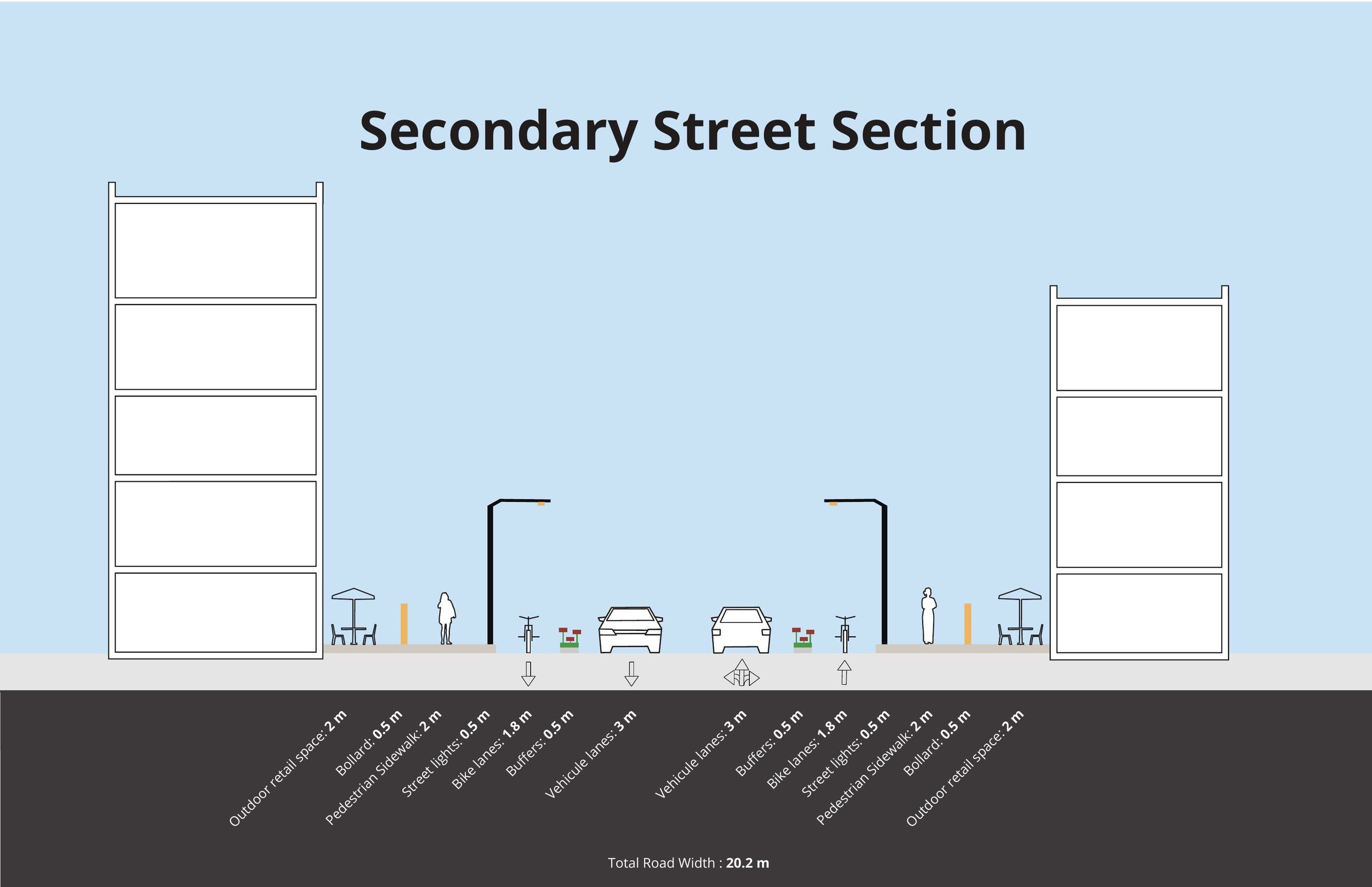
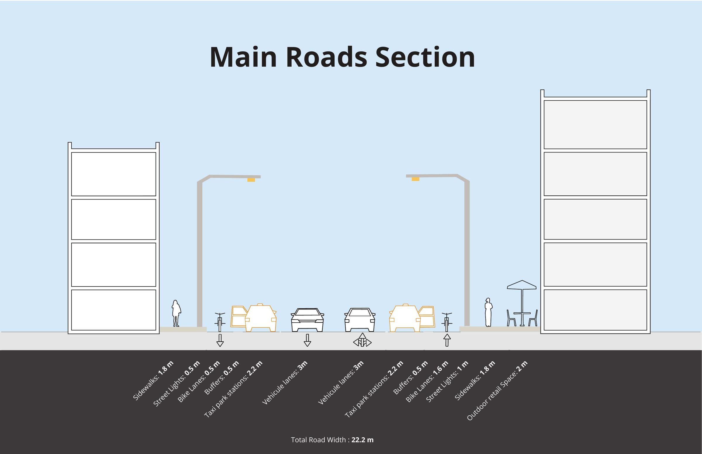
The four street sections are the part I would defend hardest. A park is only as good as the walk to it, so the streets around it are drawn and dimensioned rather than assumed: a 22.2 metre main road, a 20.2 metre secondary street, a 16 metre pedestrian boulevard with no carriageway at all, and a 9 metre block laneway. Setting those widths is what decides whether the park has an edge or just an outline.
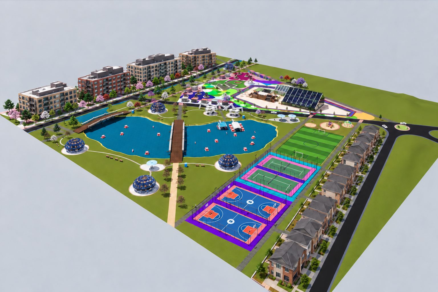
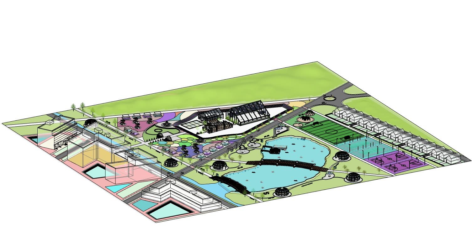
Rendered site axonometric of Serenade Park with Hydro-Stream Lake at the centre, the courts to one side, the greenhouse along the north edge and the surrounding blocks
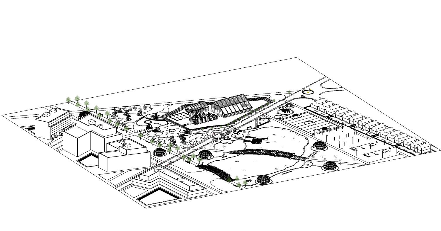
Line only site axonometric showing the paths, the lake edge, the pavilions and the surrounding buildings as pure outline
The park drawn twice more. Line work to read the ground, and flat colour to read which ground is which.
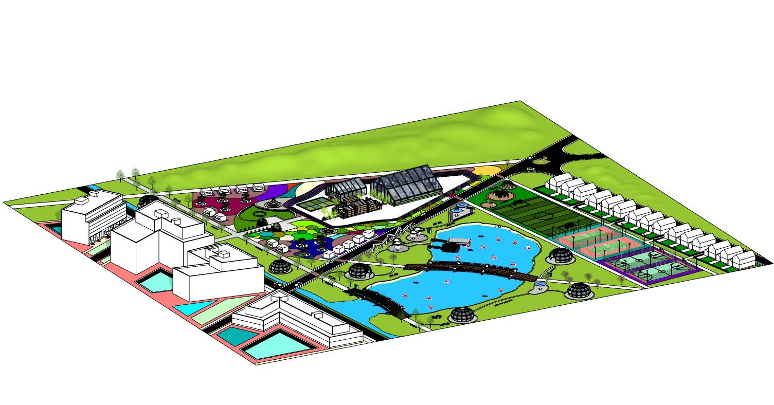
Site axonometric in flat colour with the buildings left white, so the planted grounds, courts and water read as distinct areas
The park drawn twice more. Line work to read the ground, and flat colour to read which ground is which.
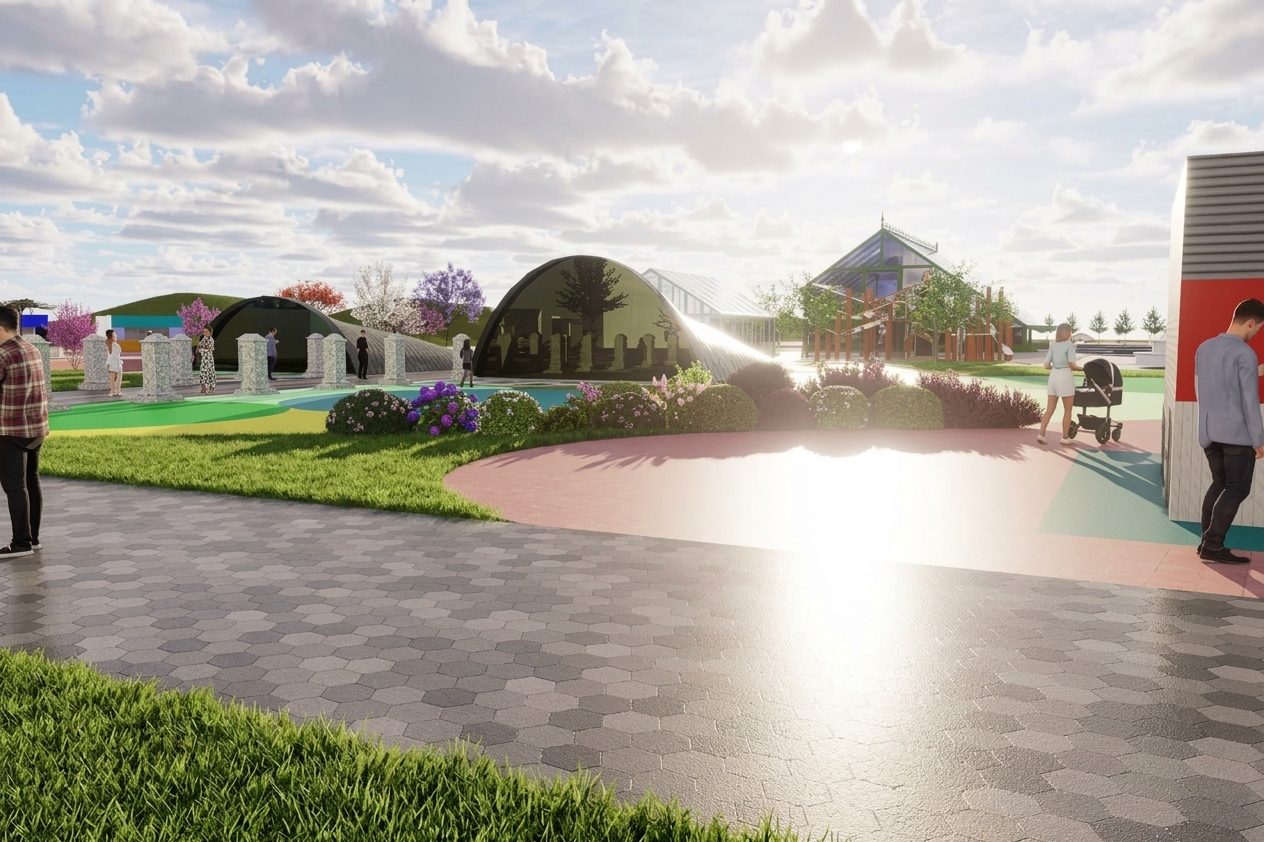
The entrance to Tri-Spectra with hexagonal paving, the dome pavilions and planting either side, people crossing in low sun
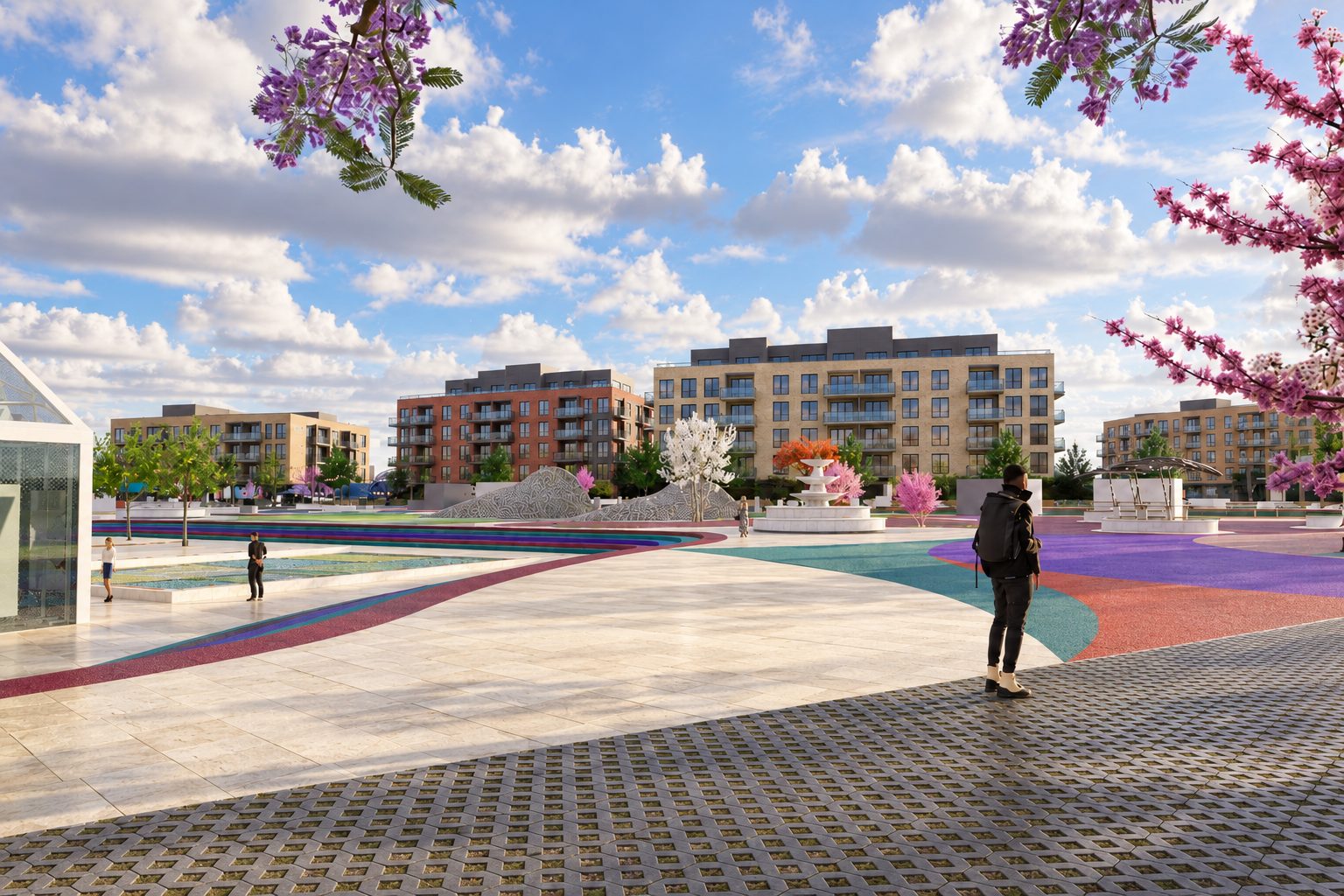
Tri-Spectra holds the north edge as the main gathering plaza. It is the piece that has to work first, because it is where people arrive.
Tri-Spectra from the side with the coloured ground pattern sweeping across it and the district buildings behind
Tri-Spectra holds the north edge as the main gathering plaza. It is the piece that has to work first, because it is where people arrive.
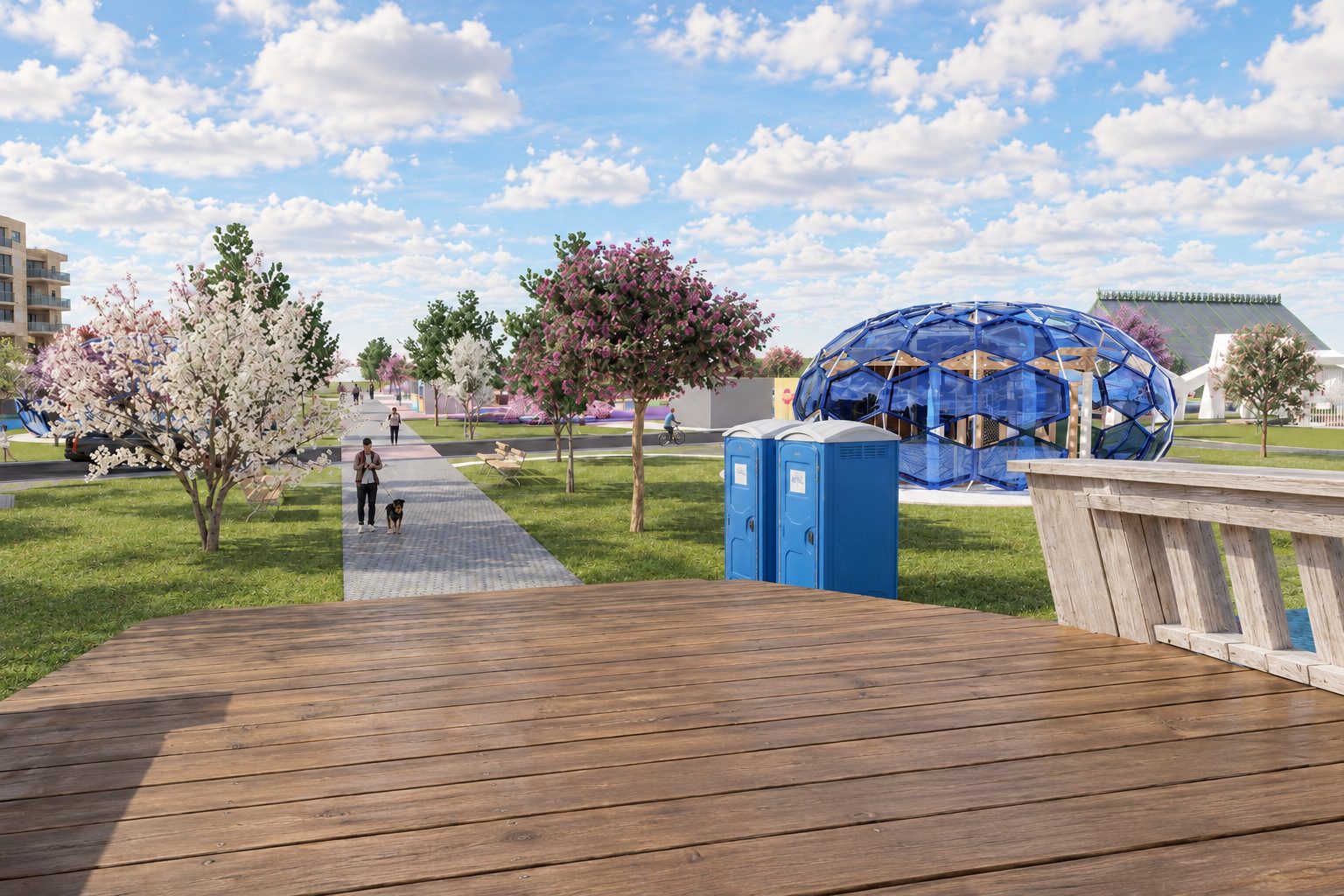
The faceted blue Arch-Flora pavilion seen across the timber deck, with blossoming trees around it
Tri-Spectra holds the north edge as the main gathering plaza. It is the piece that has to work first, because it is where people arrive.
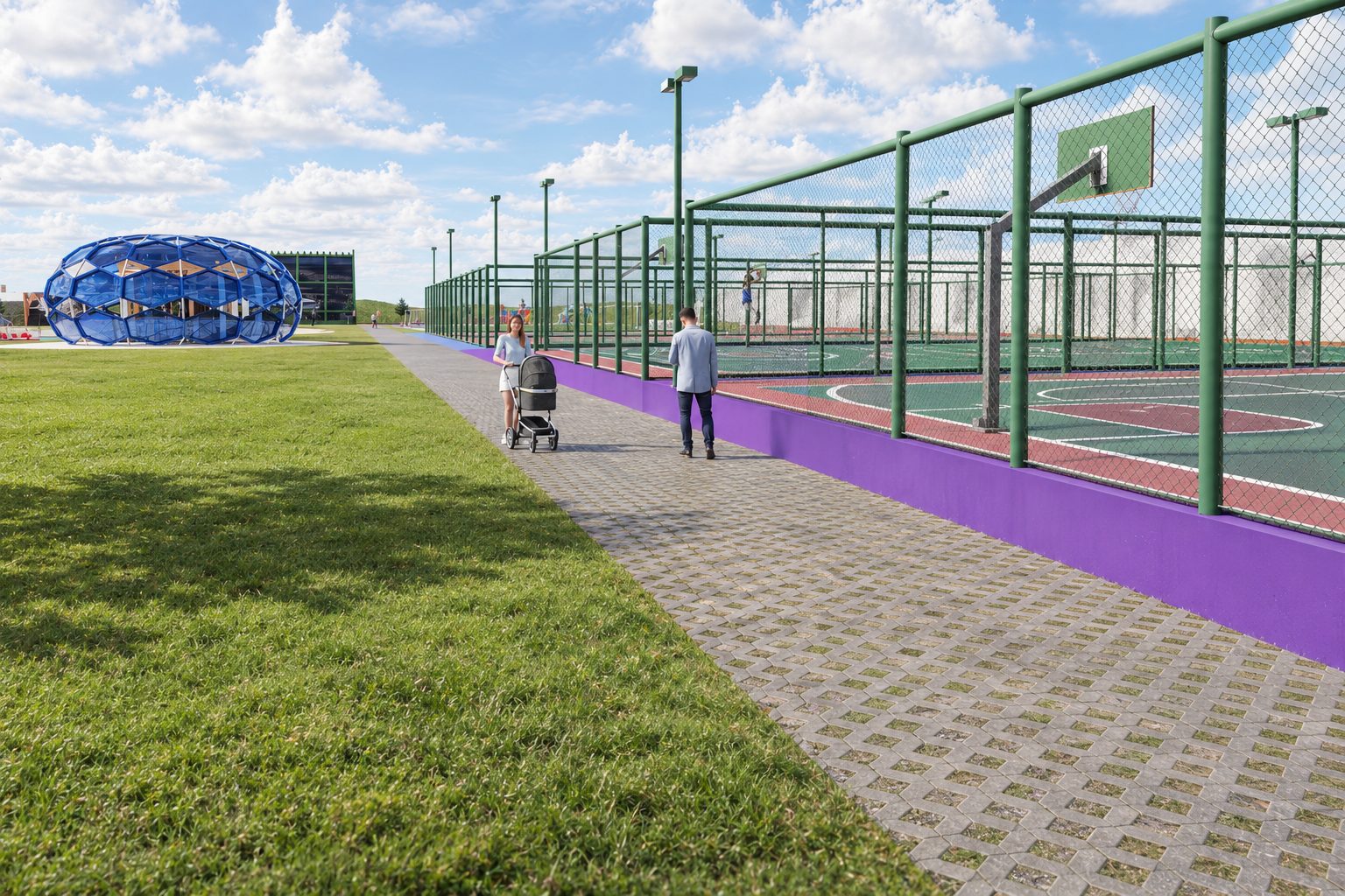
The fenced courts at The Apex along a purple paved route, with the pavilion visible in the distance
The Apex closes the southern end with the courts and the field, so the active programme sits away from the arrival plaza.
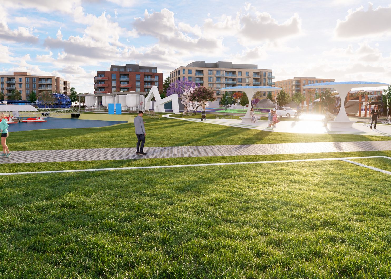
The playing field at sunset, the white canopy structures and the district buildings along the far edge
The Apex closes the southern end with the courts and the field, so the active programme sits away from the arrival plaza.
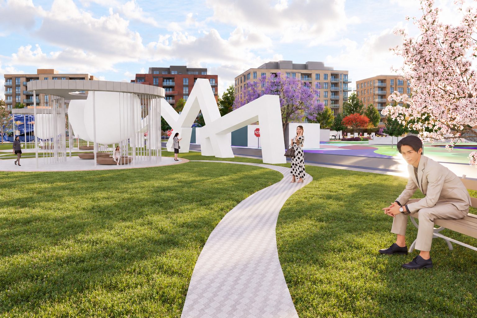
A path curving between the white arched structures with someone sitting on a bench beside it
Timberwoods keeps the treed edge, and the park is read from the balconies above it as much as from inside.
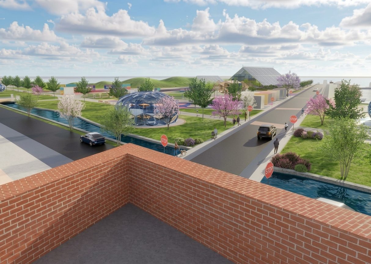
Morning view over a brick balcony parapet across the road to the park and the pavilion beyond
Timberwoods keeps the treed edge, and the park is read from the balconies above it as much as from inside.
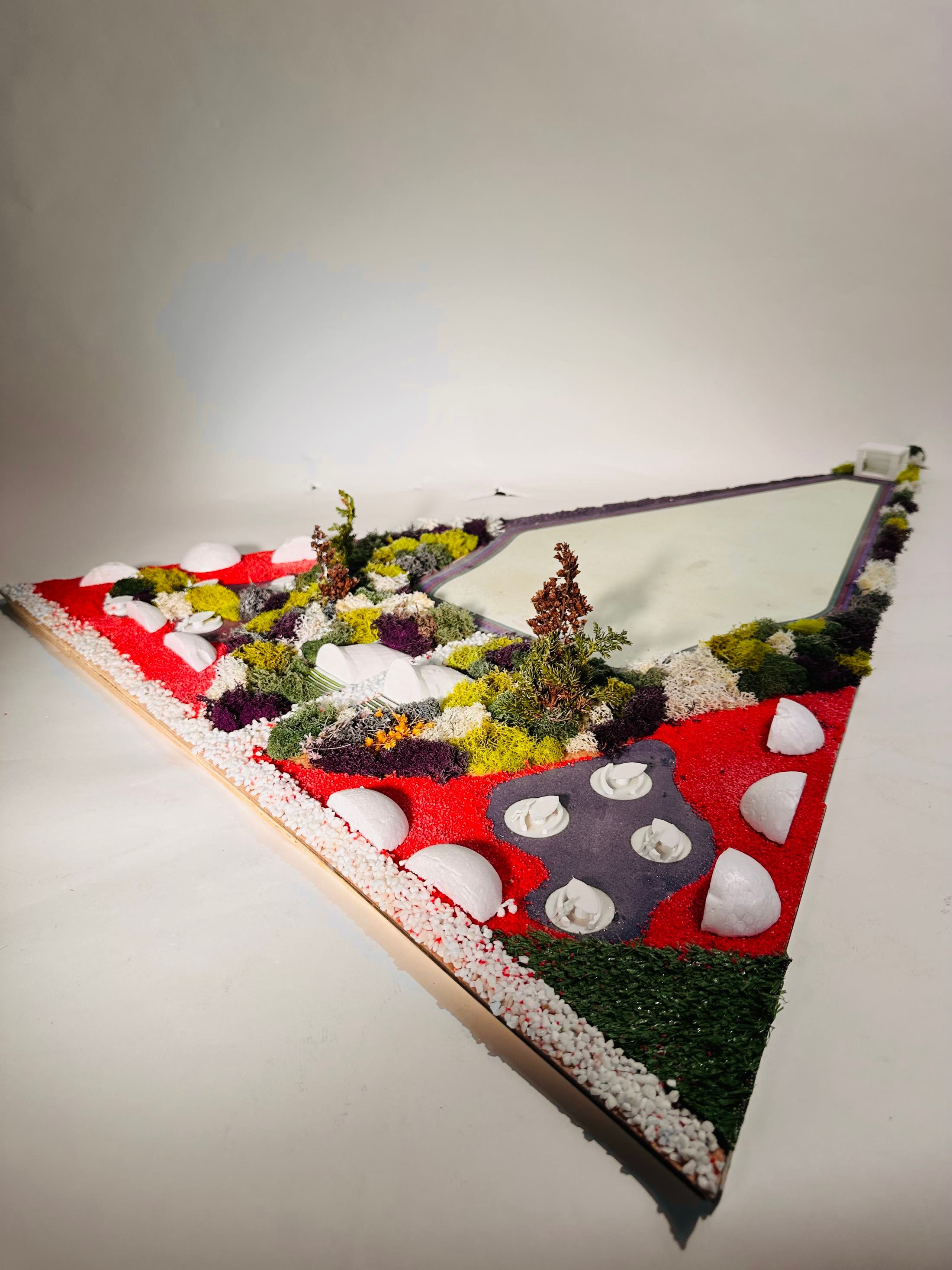
The physical model seen whole on the bench, a triangular base with the lake, the planted grounds and the pavilions in place
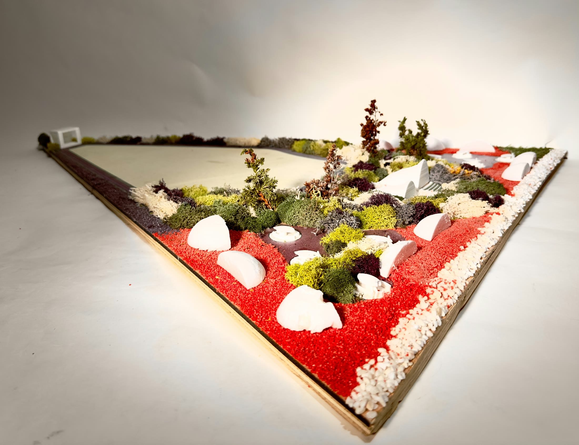
The 1 to 200 model. Building it is what settled the levels, which the drawings had been fudging.
The model from one corner, the red edge of the base running away and the planting massed across it
The 1 to 200 model. Building it is what settled the levels, which the drawings had been fudging.
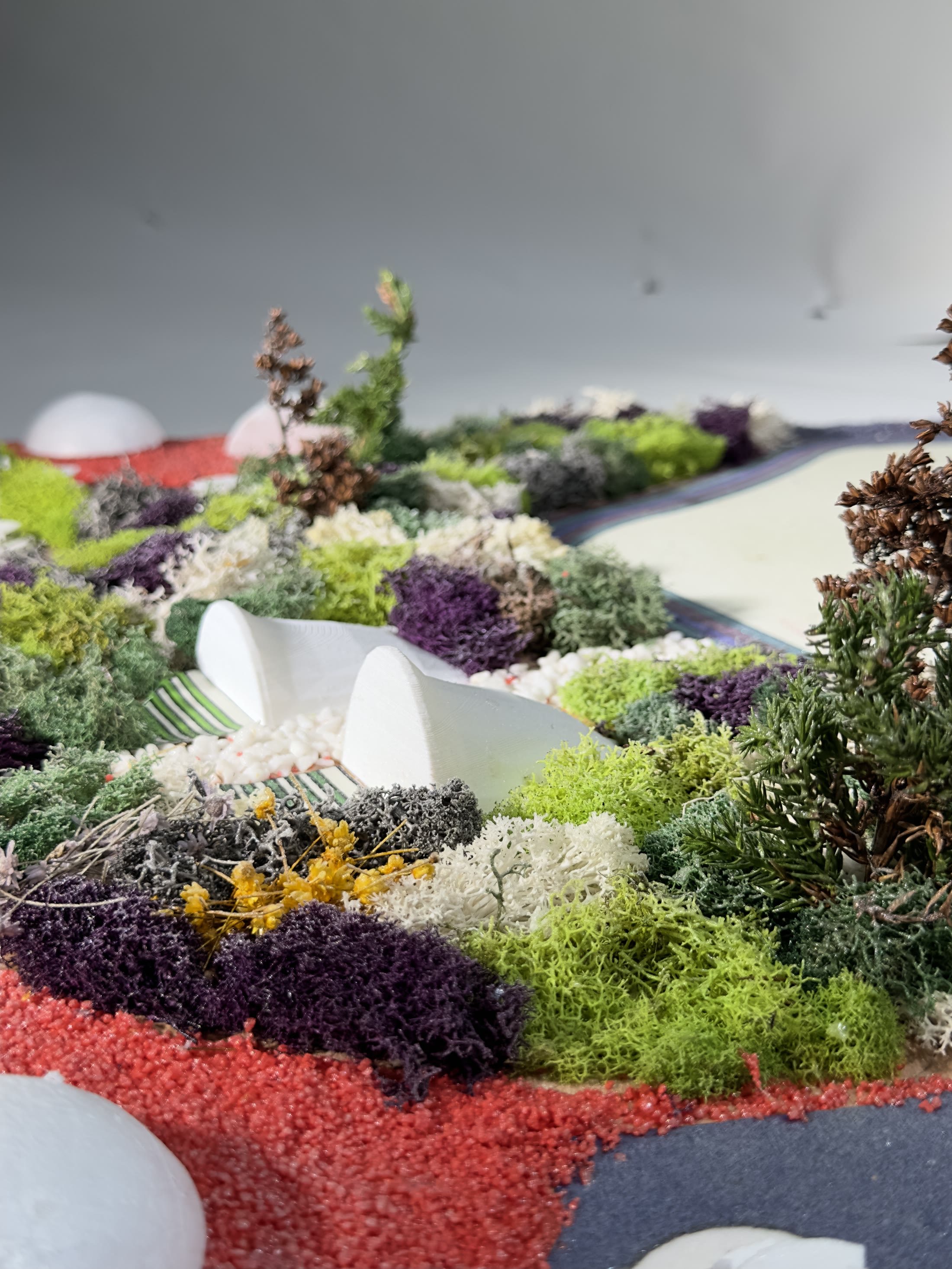
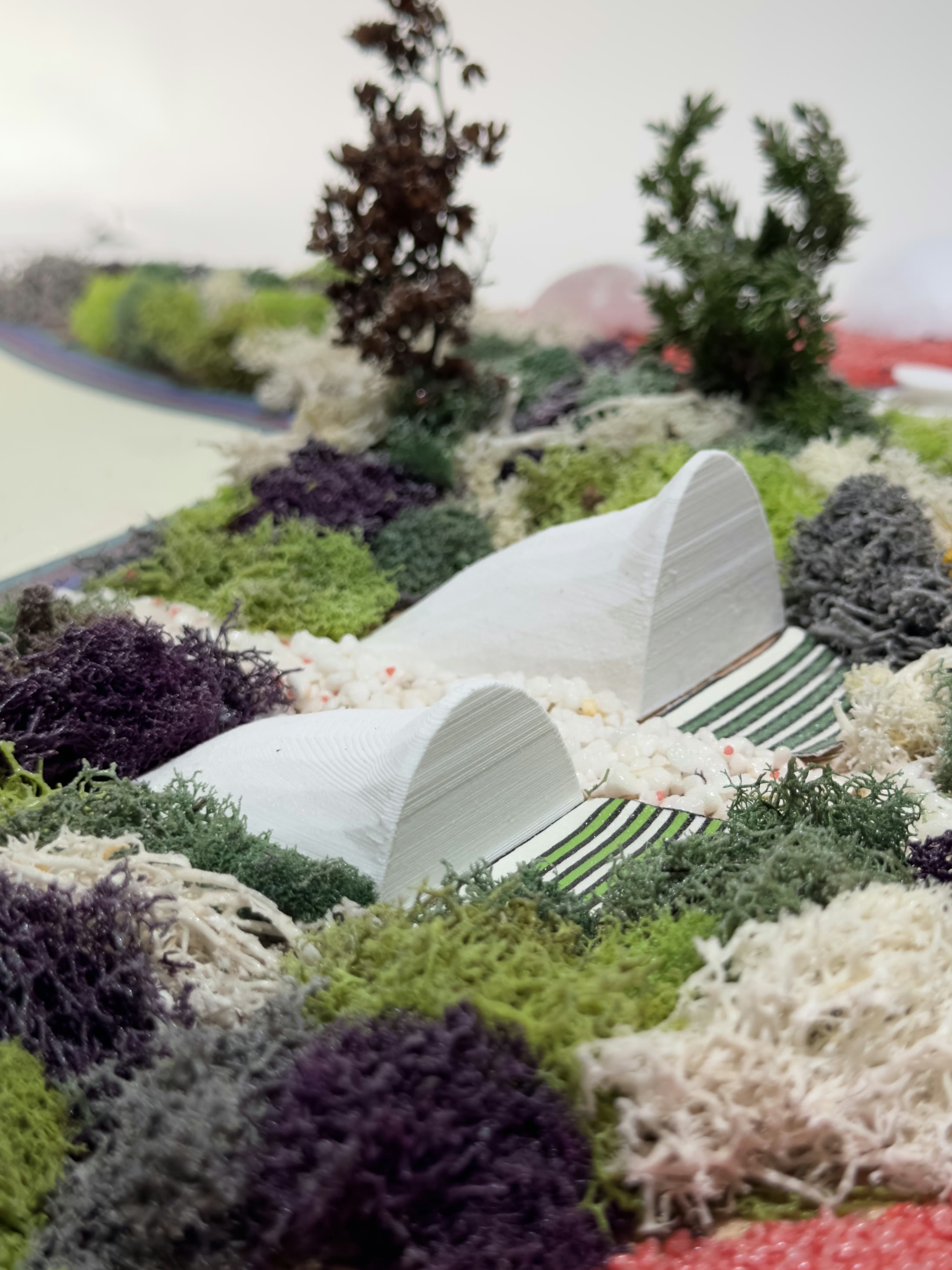
Close view into the model with the white shell of the pavilion set among dense lichen planting
The 1 to 200 model. Building it is what settled the levels, which the drawings had been fudging.
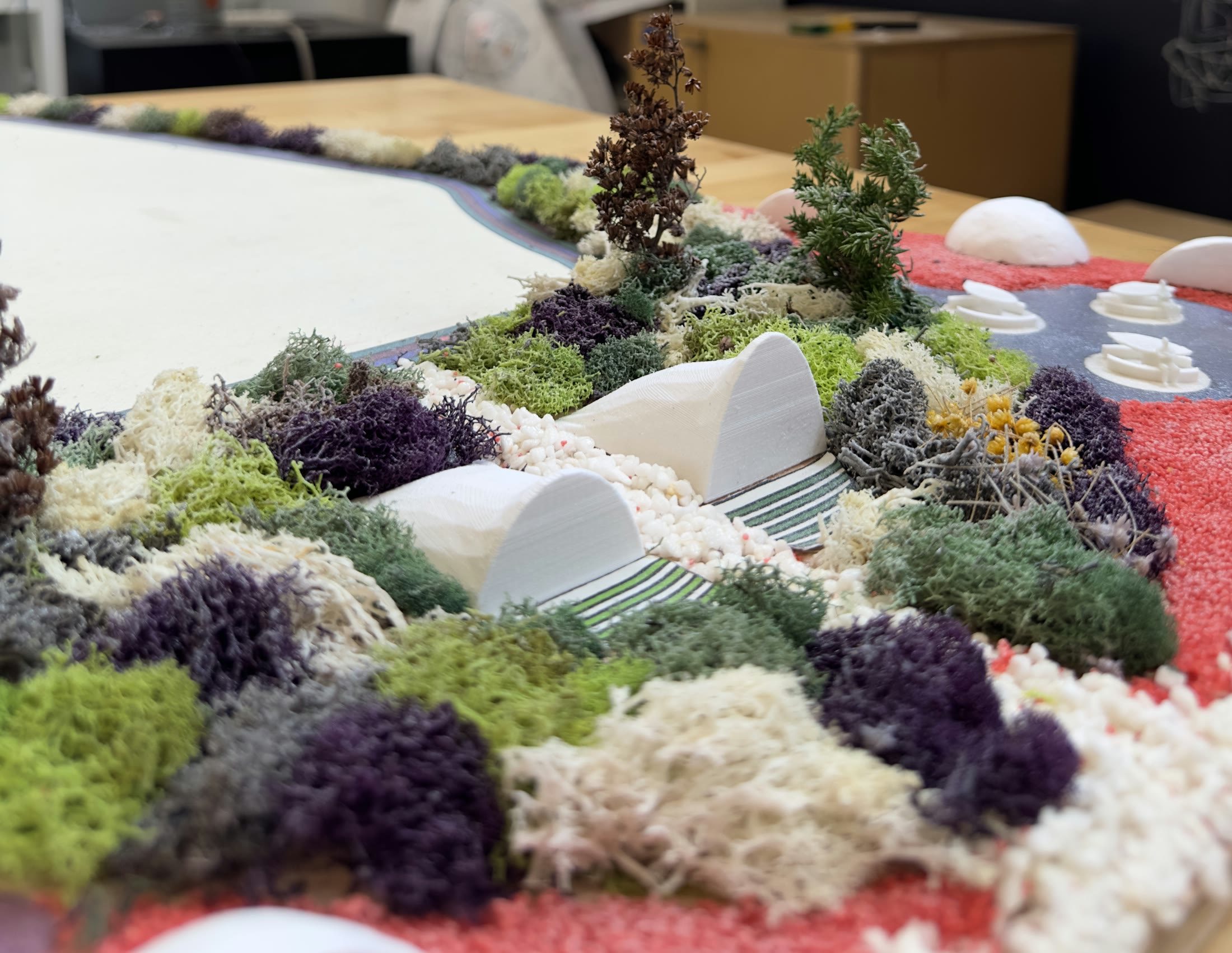
Studio close-up of the model showing the white domes and the layered planting around them
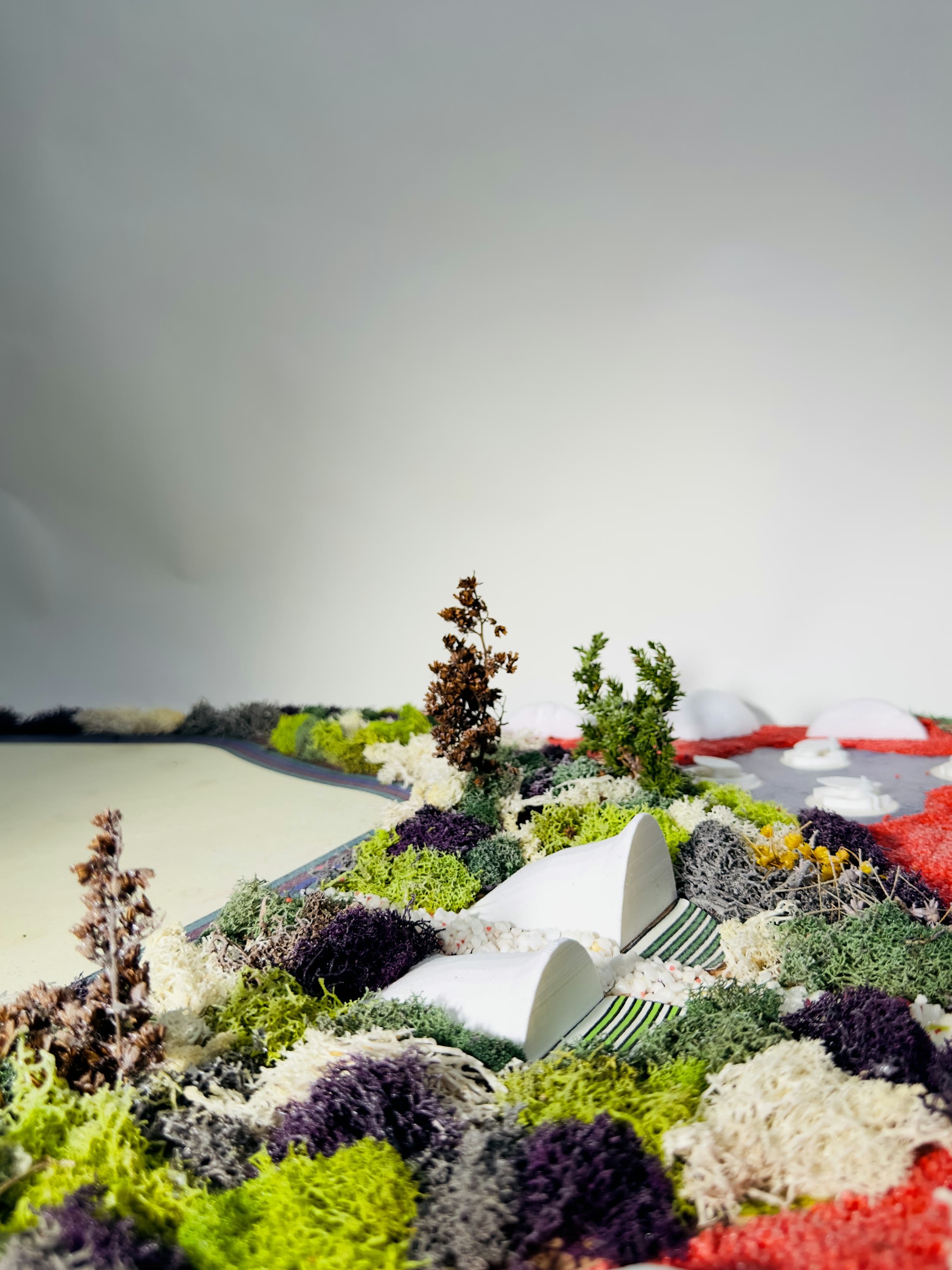
In close, where the model does its arguing. The shell structures and the density of planting are decisions the plan could not settle.
The model from the lake edge, the white shell rising out of the planting behind it
In close, where the model does its arguing. The shell structures and the density of planting are decisions the plan could not settle.
Low angle across the model with the pavilion shell against the studio wall
In close, where the model does its arguing. The shell structures and the density of planting are decisions the plan could not settle.

Drawings

Programme plan naming every part of the park, with Tri-Spectra at the north, Timberwoods along the treed edge, The Apex to the south and Hydro-Stream Lake at the centre
Programme, the named grounds
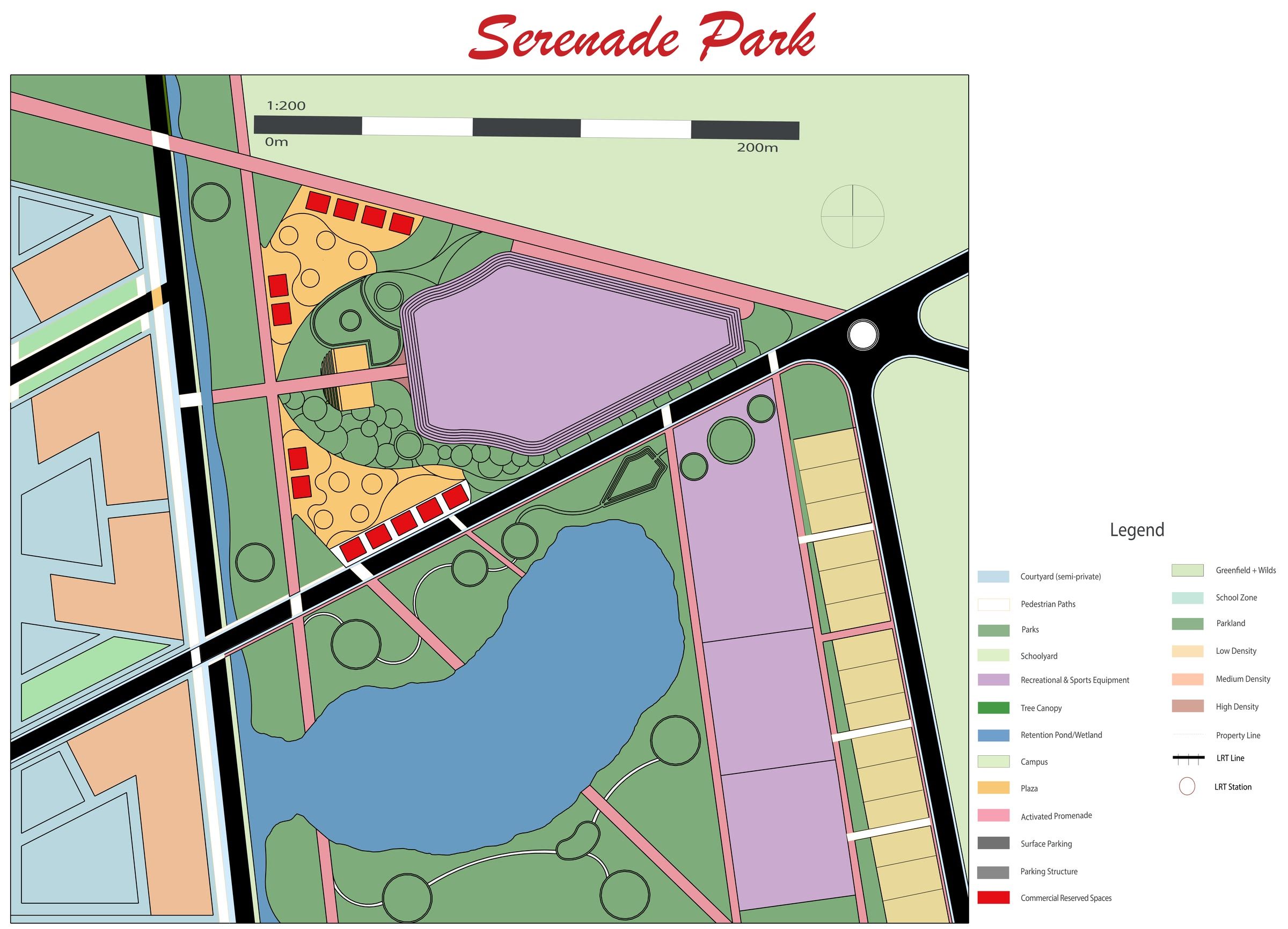
Site plan of Serenade Park at 1 to 200 coloured by land use, with a full legend and the lake and blocks around it
Site plan and land use, 1 to 200
X-ray site axonometric with the ground zones washed in colour beneath the structures above them
X-ray site axonometric
Main road cross-section dimensioned lane by lane, from building face to building face across a total width of 22.2 metres
Section, main road
Secondary street cross-section with parking, cycle and pedestrian widths set out across a total of 20.2 metres
Section, secondary street
Pedestrian boulevard section with street trees and no carriageway, dimensioned across 16 metres
Section, pedestrian boulevard
Block laneway section, the narrowest of the four at 9 metres, with a single shared surface between buildings
Section, block laneway
Earl Armstrong proposed plan, colour coded by use and storey height, with the light rail line and station marked, and a legend covering residential, commercial, institutional, parks, corridors and community farm
Earl Armstrong area plan, Team 1 with Chloe, Nan and Sophie
Second sheet of the Earl Armstrong team plan, setting out the analysis behind the block pattern
Earl Armstrong area plan, sheet two